Elizabeth and Steve's Excellent 2006 Hawaii Adventure - Kauai
This was the second island on our (almost) three-week Hawaii Adventure. Please also check out our first stop, Hawaii, the "Big Island".
We heartily recommend the Hawaii guidebooks by Andrew Doughty and Harriett Friedman -- they're invaluable resources!
Kauai
May 14 - 15 (2 nights), Waimea, Waimea Plantation Cottages
May 16 - 20 (5 nights), Hanalei, Sealodge
May 21 - 24 (4 nights), Kapa'a, Honua Lani Gardens

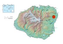
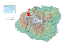
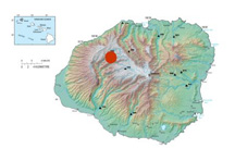
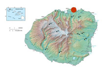
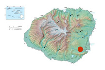
Kauai map images on this page are from a USGS Pacific Islands Water Science Center Web site.
Some notes on Kauai paper maps are here.
Waimea, Kauai
We flew to Kauai, and stayed in Waimea, Kauai -- not to be confused with Waimea, Hawaii, where we stayed on the 13th! Waimea is at the mouth of the Waimea River, and it's from here that you can drive north up and into the Waimea Canyon.
Waimea Canyon

Waimea, Kauai
Waimea Canyon
"End of the Trail" on Ditch Trail (#8 on this map -- note the short little spur) in Koke'e State Park -- actually 20 or so fee short of the actual end of the trail, a knife edge lookout above terrain suitable only for these nimble creatures.

A view from the end of the trail.

The waterfall in the above image, through a telephoto lens.

A Pueo -- a Hawaiian Owl. (A little out of focus; I need to practice shooting moving targets!) From the Ditch Trail.


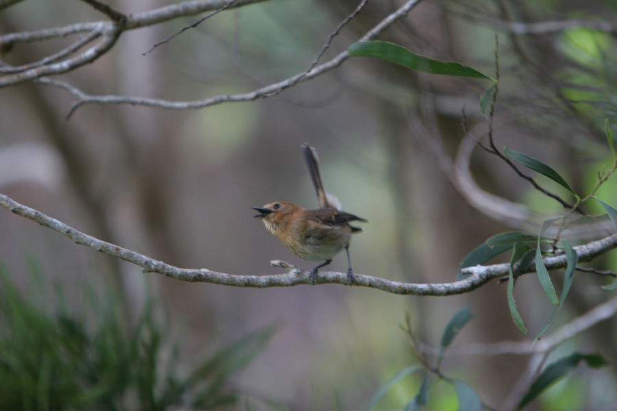
A Kauai 'Elepaio -- found only on Kauai.
Waimea Canyon
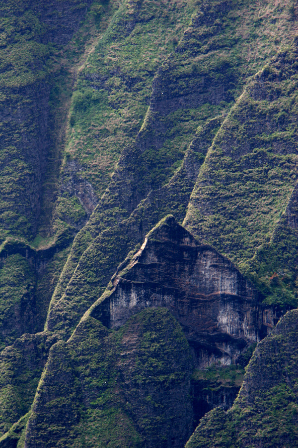
The Na Pali Cliffs, from Pu'u Kila lookout.

A telephoto shot of a small section of the above photo.
Hanalei, Kauai
We drove counterclockwise around the island from Waimea to Hanalei, where we stayed for 5 nights.
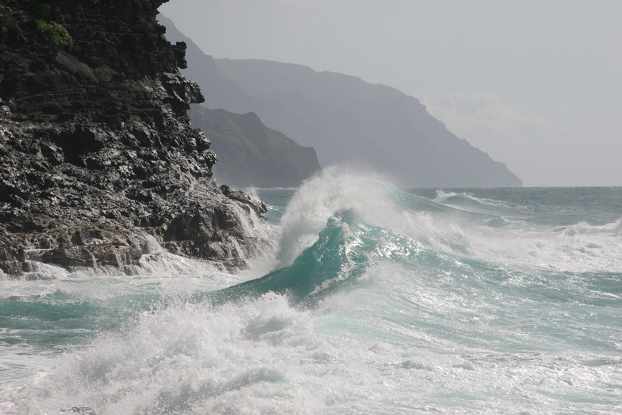
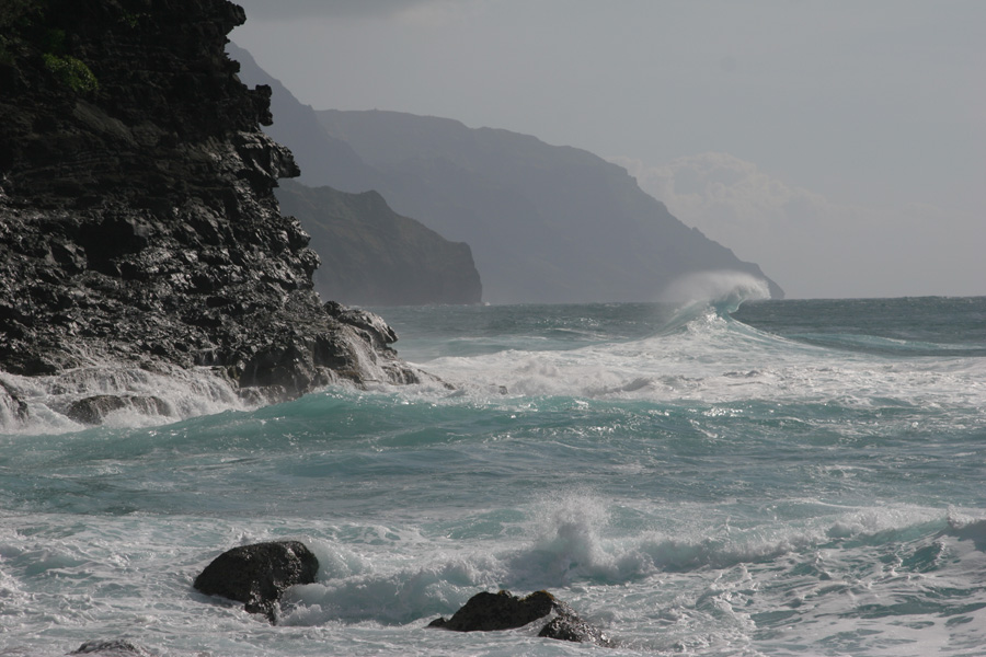
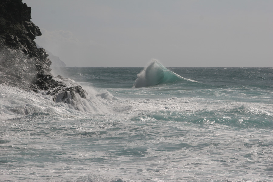
Ke'e Beach and the Na Pali Cliffs
Just west of Ke'e Beach, which is at the western end of the main road on the north coast of Kauai. Ke'e Beach is as far as you can go by car in a counterclockwise direction around the island. The Na Pali Cliffs (seen below) support only (beautiful!) trails, not roads. And there is no connection -- by foot or otherwise -- between the bottom and the top of the Na Pali cliffs (the bottom being reachable from the Kaualau Trail, which starts here at Ke'e Beach, and the top being reachable via Waimea Canyon Road (and trails that branch off from it), which is accessed only from the south side of the island).


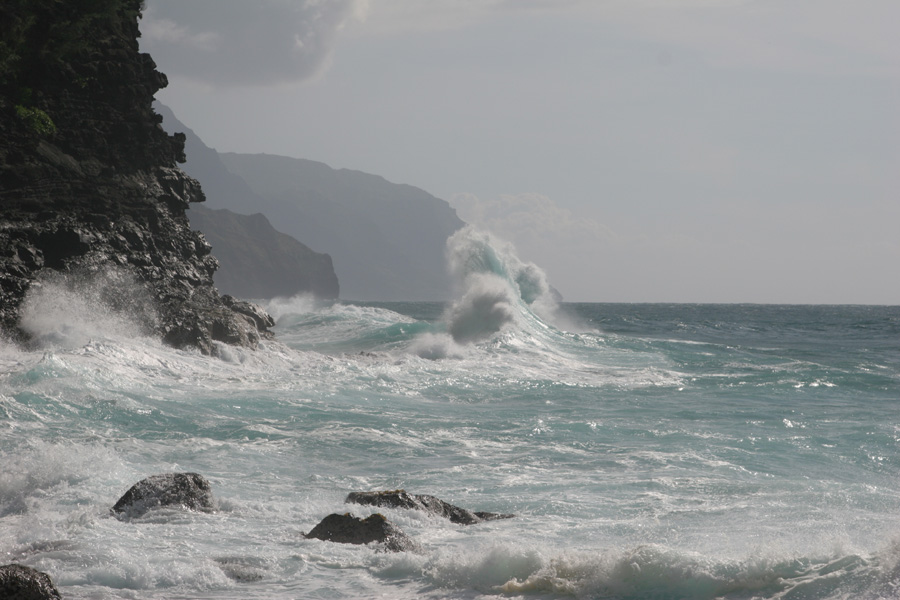
Kaualau Trail -- Along the Na Pali Cliffs
We hiked along the first two miles of Kaualau Trail, which skirts along the base of the first nine or so miles of the Na Pali Cliffs (from Ke'e Beach, visible in the first photo). Incredible trail!


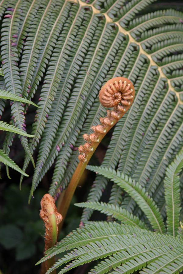
Orchid beside the trail.

A view from Hanakapi'ai Beach, which is at the two-mile point along the Kaualau Trail.


Between Princeville and Hanalei
Taro fields.


One of the ubiquitous wild chickens on Kauai.

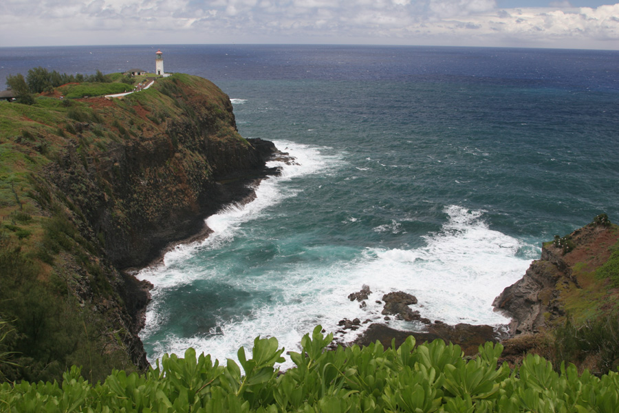
Kilauea Lighthouse
A wonderful bird sanctuary.

Near Kilauea
Flowers!

Anini Beach
Kite surfers at Anani Beach, between Kilauea and Princeville.

Kapa'a, Kauai
Queen's Bath
Water falls into the ocean! Near "Queens Bath" in Princeville

More photos of Queen's Bath. A spectacular place!


This one seemed quite comfortable in the surging waves -- right near the rocks!

Kepuhi Beach

Fish in a little pool.


Ho'opi'i Falls, inland from Kapa'a


We drove back up to Waimea Canyon Road to hike to the Alaka'i Swamp. We got bogged down in Kauai red mud, and didn't make it. And it was a cloudy, rainy day, which nonetheless offered some nice close-up views.


A glimpse through the clouds from teh Pihea Trail (not too far from the Pu'u u Kila Lookout). The ocean is just barely visible, 4000 feet below.

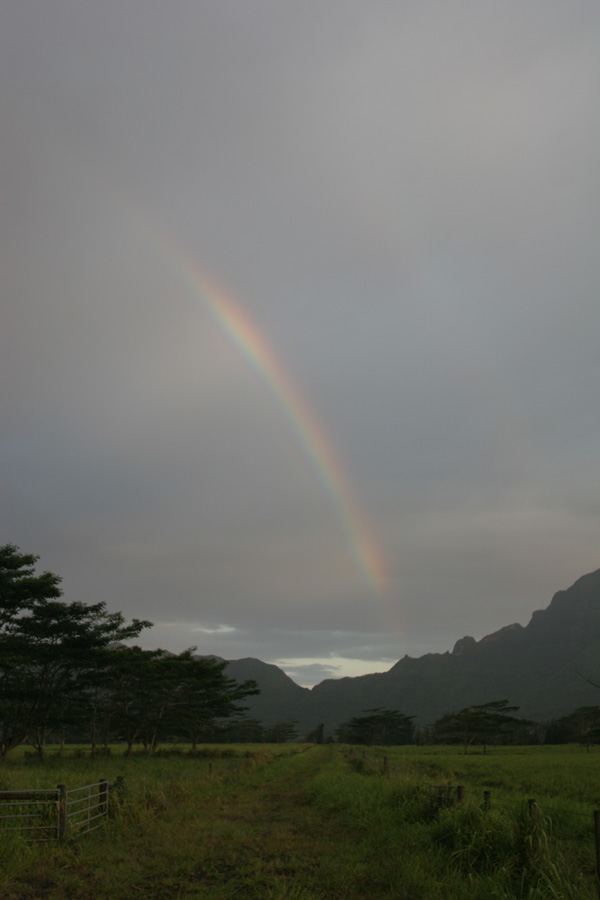
A rainbow near Puhi, looking south, near Lihu'e in southeast Kauai. On our drive back to Kapa'a from Waimea Canyon.
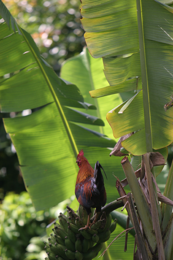
Roosters like banannas! Who knew? Just off our deck.